Valley of Fire
(Valley of Fire State Park)

Valley of Fire - To reach Valley of Fire State Park, drive northwest on Interstate 15 about 33 miles from its intersection with U.S. 95, leaving the freeway at Exit 75. Follow the directional signs about 20 miles to the visitor center in the park. There are many options for hikes in Valley of Fire with varying distances and difficulty levels. Few of them involve trails, so much of the hiking will be done in drainages and climbing to ridges, involving rock scrambling in many cases. The visitor center can provide you with information regarding the areas that you are allowed to enter. If you have not visited before, you will be amazed by the unusually shaped red sandstone formations on view in the park. For further information regarding hikes in Valley of Fire, contact Brian Dodd (briandodd (at) cox.net)
Valley of Fire High Point
(Valley of Fire State Park)
Valley of Fire High Point - There are three versions of the hike that climbs up to the highest point in the red rock of the park. They are all strenuous and around 5 miles in length. Two are out and back and one is a loop. The most difficult is an out and back from the Mouse's Tank TH and has an ascent of 1600 feet. The route indicated below is an early version of the out and back from the Visitor Center area. It has 1500 feet of gain. For further information regarding hikes in Valley of Fire, contact Brian Dodd (briandodd (at) cox.net)
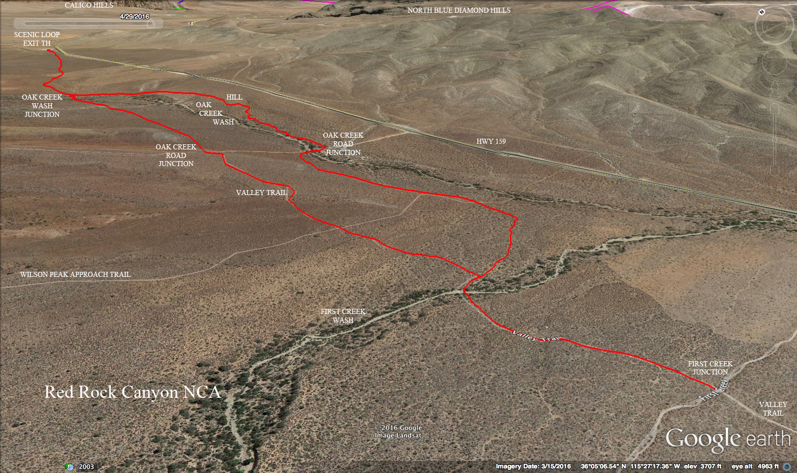
Valley Trail
(Red Rock Canyon NCA)
Valley Trail - There is a trail that connects the Red Rock Overlook turnout with Spring Mountains Ranch State Park traveling along Cottonwood Valley on the north end. The entire trail, point to point, is 3 miles. An easy and scenic partial loop is made by beginning at the scenic loop exit parking and hiking out and back to the First Creek Trail adding another one of the many trails found crossing the valley here. This partial loop is 5 miles long with only 300 feet of elevation gain. Views are of the Red Rock Canyon escarpment and Oak Creek crossings.
Virlis Fisher Arch
(Lake Mead NRA - Nelson, Nv.)
Virlis Fisher Arch - To reach the starting point of this hike, drive south on Highway 95 where it splits from Highway 93 near Railroad Pass, turn left on Highway 165 in about 10 miles, then drive 9.5 miles before turning left on a gravel road and park immediately. The hike begins through the desert to a wash, which will be followed as it climbs toward a rocky outcropping. A slight trail passes a caveat at the edge of a rock formation, then climbs up a chute, eventually getting to the base of the arch. This is an out and back hike totaling 4 miles with a vertical gain of 350 feet. It can be combined with a hike to a nearby natural bridge called Bridge Spring Arch which is found down a wash leading toward Lake Mead. The combined hike to both arches results in a 5-mile trek.
 Valley of Fire - To reach Valley of Fire State Park, drive northwest on Interstate 15 about 33 miles from its intersection with U.S. 95, leaving the freeway at Exit 75. Follow the directional signs about 20 miles to the visitor center in the park. There are many options for hikes in Valley of Fire with varying distances and difficulty levels. Few of them involve trails, so much of the hiking will be done in drainages and climbing to ridges, involving rock scrambling in many cases. The visitor center can provide you with information regarding the areas that you are allowed to enter. If you have not visited before, you will be amazed by the unusually shaped red sandstone formations on view in the park. For further information regarding hikes in Valley of Fire, contact Brian Dodd (briandodd (at) cox.net)