Keystone Thrust
(Red Rock Canyon NCA)
(Red Rock Canyon NCA)
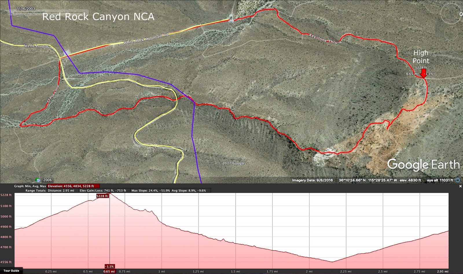
 Keystone Thrust - This hike begins at the White Rock Trailhead parking area at the end of the gravel road that starts at Mile Marker 6 of Red Rock scenic loop. The loop hike starts on the White Rock Trail, then turns right onto the Keystone Trail and winds behind a limestone outcropping known as Cactus Hill. Total out and back distance to the top of Keystone Thrust Canyon is 2 miles. That distance can be extended by dropping into the canyon to view the thrust anomaly and returning to the trailhead as a loop around Cactus Hill and/or down the Keystone Wash, under the Scenic Loop Road to the junction of the Grand Circle Trail. A right turn will take hikers back up to the White Rock Road. Total stats for the loop hike are 3.5 miles with 700 feet of elevation gain. There are remains of an old car chop operation on the hillside above the thrust area.
Keystone Thrust Loop


Sandstone Quarry / Keystone Thrust Loop


Kraft Mountain Loop
(Red Rock Canyon NCA)


Kraft Traverse
(Red Rock Canyon NCA)

East to West


West to East


East to West including Gateway Canyon return


South to North


Kyle Canyon Drainage
(Spring Mountains NRA)
(Spring Mountains NRA)
 Kyle Canyon Drainage - After the Springs Mountains NRA Visitor Center was built in 2015, the trails were improved below Old Town. Now there is a nice descent route of connecting trails that begin at the Echo Trailhead in Kyle Canyon and end at the Visitor Center. This route takes hikers through the interesting little township of Old Town and down the Acastus Trail, named for a rare butterfly found in that area. The point to point hike can finish with a perusal of the visitor center and surroundings trails. The easy to moderate descent hike point to point is 5 miles with 130 feet of elevation gain and 1000 feet of elevation loss.
